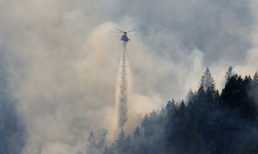
Firefighters remain vigilant as hot, dry conditions persist
Ashland.news staff report
Scorching heat and gusty wind have not kept crews from keeping more than 70 lightning-caused fires within their footprints.
The Neil Creek Road Fire, south of Ashland and west of Interstate 5, is still covering approximately 250 acres and is 30% contained, meaning a protective line is in place with little chance for the fire to move beyond it, according to Wednesday morning fire status updates.
Meantime, the Jackson County Sheriff’s Office and Jackson County Emergency Management are keeping evacuation notices in place for JAC-542, JAC, 558 and JAC-536, according to the county evacuation map. All other evacuation orders have been lifted.
For firefighter safety, one lane on southbound Interstate 5 is shut down between miles 8.5 and 10.5. According to the Oregon Department of Forestry’s Wednesday press release, more than 1,500 firefighters are working the fires.
Officials redeployed a Cal Fire strike team to help with the Hagelstein Fire, burning north of Klamath Falls, near Highway 97.
“We were in a position to share resources to an emerging need in the region, without reducing our capabilities or readiness,” said Tyler McCarty, ODF incident commander. “We were just in that position less than a week ago, and we understand how important it is to get those resources as early as possible.”
With high temperatures forecast through the rest of the week, firefighters are remaining vigilant and ensuring fire perimeters are completely extinguished, according to Derek Gasperini, public information officer with ODF’s Team 3.
“With very high heat and low relative humidities, things are dry and there is a high possibility of ignition for any sparks or embers around the fires,” he said.
The Deming Gulch Fire
Northeast of Buncom in the Applegate, the fire is estimated to be burning on more than 250 acres. Crews have contained 35% of the blaze and have a protective line around the entire perimeter of the fire and are extinguishing hot spots.
The Heppsie Mountain Fire
Located south of Highway 140, the blaze is about 100 acres and 75% contained, with a protective line around the fire’s perimeter.
The Poole Hill Fire
Located south of the Heppsie Mountain Fire, the blaze continues to burn on 12 acres and is 80% contained.
The Jim Me Peak Fire
Located in a remote area south of Applegate, the fire is nearly 150 acres and is 30% contained.
The Palmer Peak Fire
Located southeast of the Jim Me Peak Fire, the blaze is about 70 acres and 30% contained.
OFFICIAL INFORMATION:
Jackson County Emergency Management: Facebook page with updates
ODF Southwest Oregon District: Facebook page with updates
Genasys Protect: Updated evacuation maps
Tripcheck.com: Information about road closures
Email Ashland.news associate editor Steve Mitchell at stevem@ashland.news.